AccuWeather Forecast: Chances of showers, thunderstorms this evening; gusty winds overnight


Takeaway of the Day
Scattered showers and thunderstorm chances will continue throughout the Bay Area this evening. Strong winds are expected, especially at the coast. Overnight lows will drop into the 40s and 50s throughout the region.
WINTER STORM WARNING for Lake Tahoe
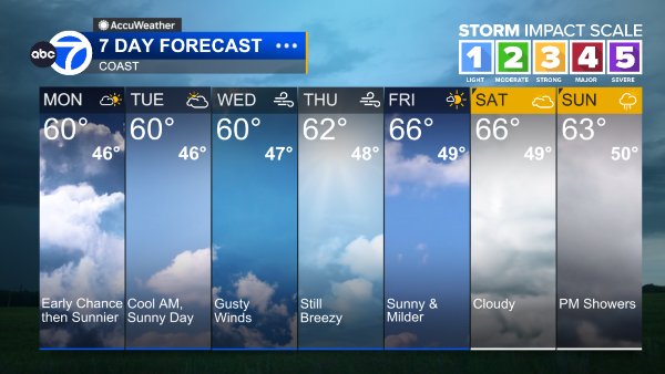
Rain and thunderstorm chances will continue through Monday morning. Warmer, drier conditions return to the forecast Monday afternoon and continue through the rest of the week.
LIVE: Track rain in San Francisco Bay Area with Live Doppler 7
A Look Ahead
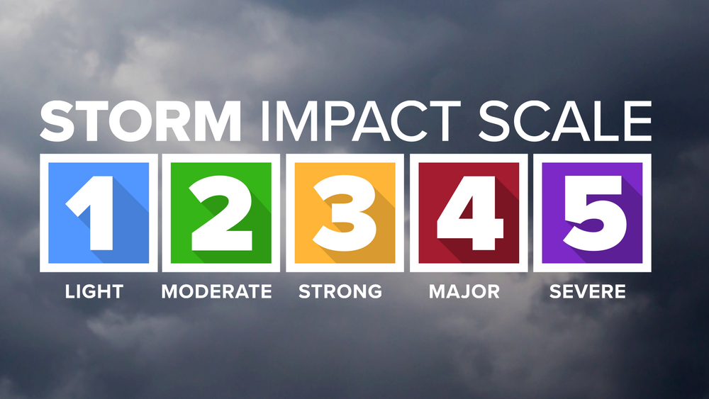
Lingering rain, a Level 1 system with a possible thunderstorms continues Sunday. Weekend rainfall will generally be from .50" to over an inch and a half. The bulk of it arriving today.
A few lingering showers possible Monday and cool.
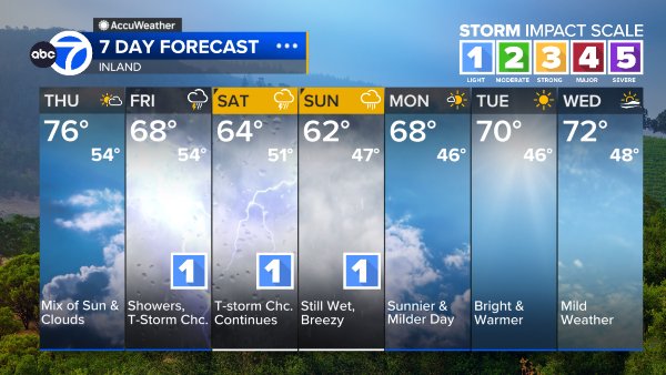
Dry and warmer days resume the rest of the week.
Coast
Bay Shoreline

Inland
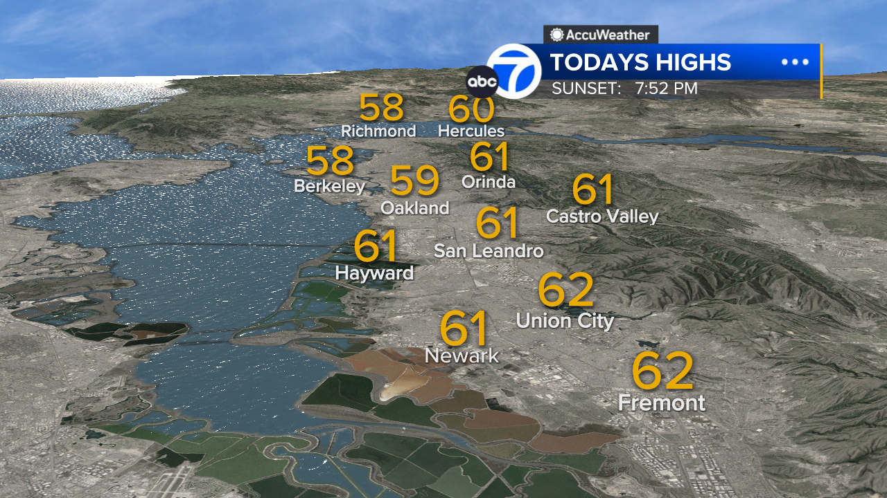
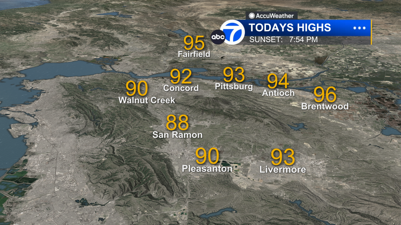
East Bay High Temps
Inland East Bay High Temps
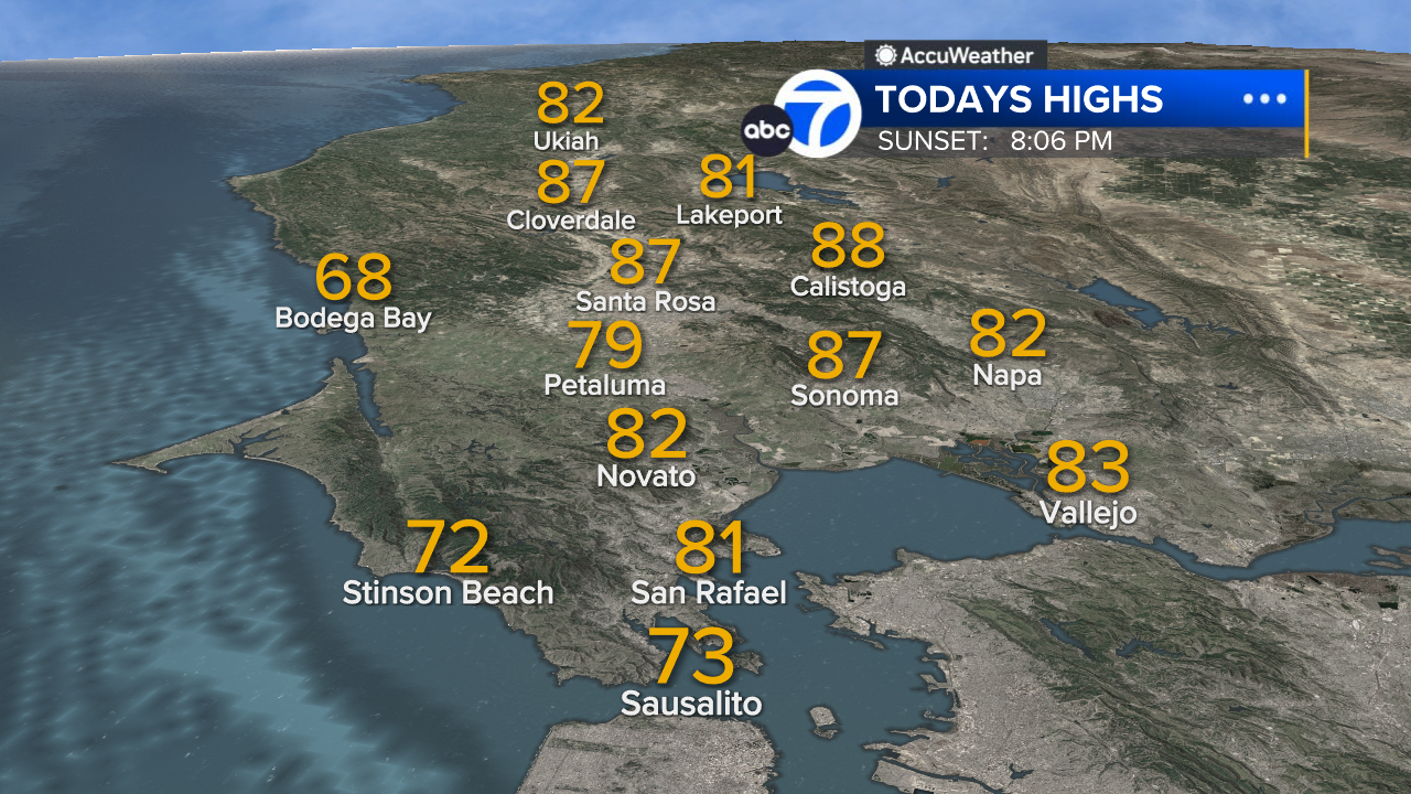
North Bay High Temps
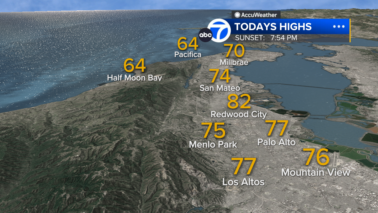
Peninsula High Temps
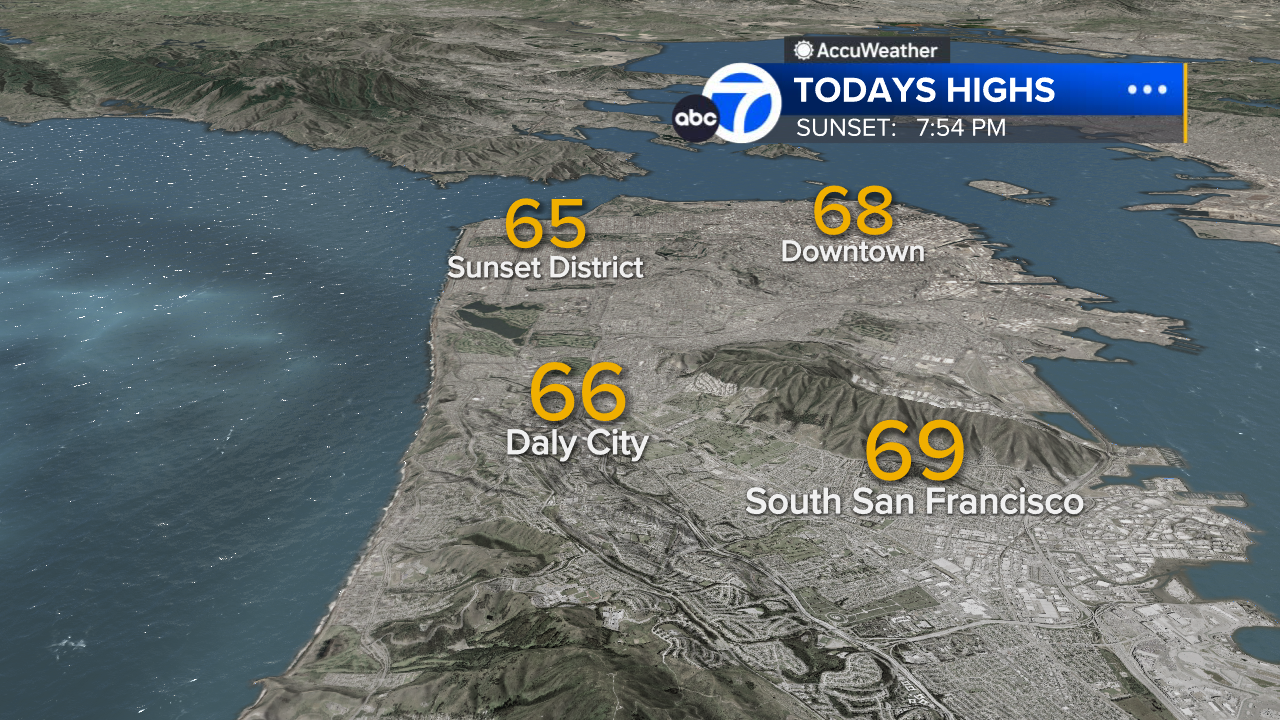
San Francisco High Temps
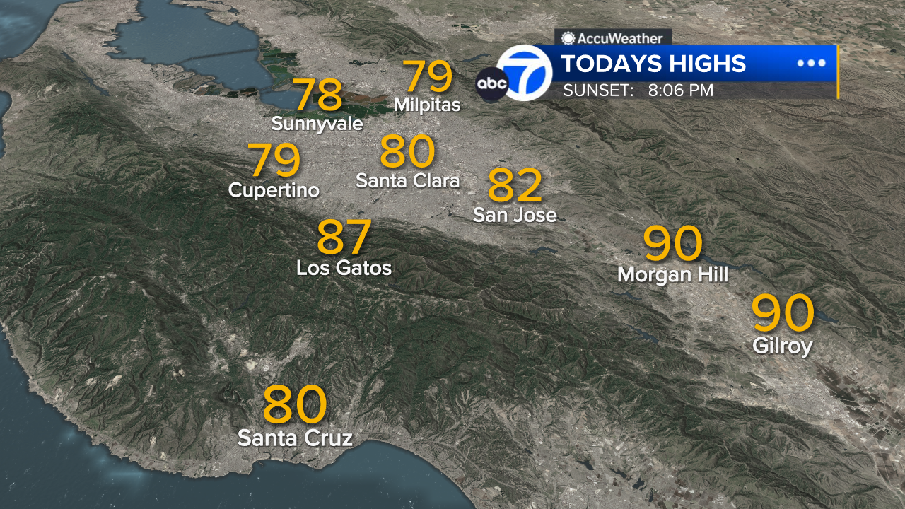
South Bay High Temps
- Download: ABC7 Accuweather app for iPhone and Android
- CA Weather Tracker: Reservoir levels, precipitation trends, snowpack totals
- Weather Radar: LiveDoppler7 radar images
- Weather Alerts: Current Watches and Warnings
- Share: Tag weather photos #ABC7Now
SHARE YOUR PHOTOS: We love seeing photos and videos from where you live! Share yours by posting with #abc7now. You must have taken the image/video or otherwise own all rights to it and agree that KGO-TV and its licensees can use, edit and distribute it without restriction in all media. Full terms: abc7news.com/share