AccuWeather Forecast: Cooling marine layer redevelops overnight; warm tomorrow


Takeaway of the Day
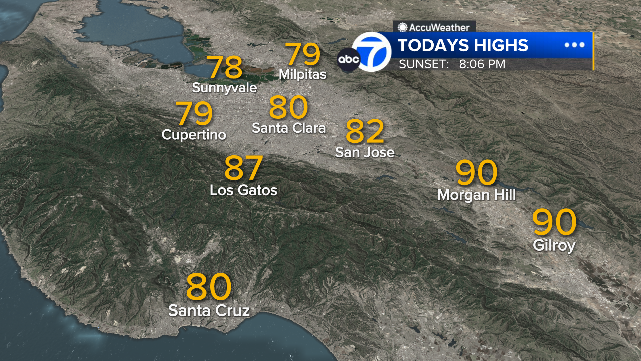
Following yesterday's sharp cooldown, temperatures bounced back today. At 2:30 p.m., temps were already in the upper 80s to lower 90s inland, with a couple more hours of warming left.
Going into the evening hours, a strong onshore wind flow will help the cooling marine layer to redevelop. However, there does not appear to be enough moisture content to pose the chance of widespread or significant early morning drizzle.
A Look Ahead
Tomorrow and Friday will be sunny with summerlike warmth. High temperatures will range from around 80 degrees near the bay to lower 90s in the warmest inland areas.
However, the weekend will bring breezy and much cooler weather, with Saturday's highs about 8 to 10 degrees lower than Friday's highs. This cooler pattern will continue into early next week
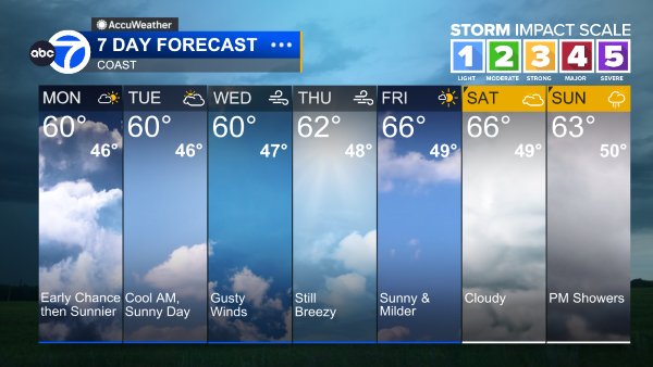
Coast
Bay Shoreline

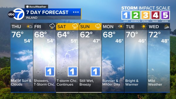
Inland
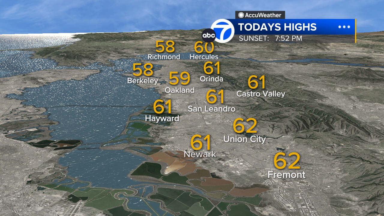
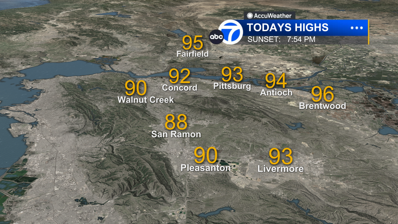
East Bay High Temps
Inland East Bay High Temps
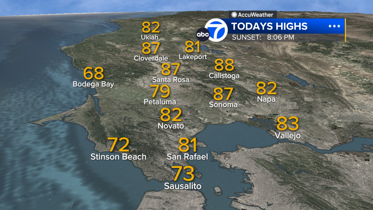
North Bay High Temps
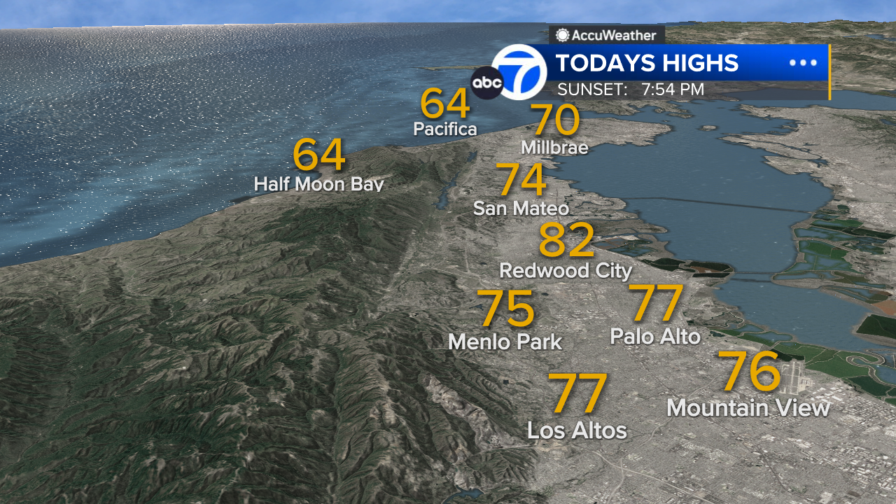
Peninsula High Temps
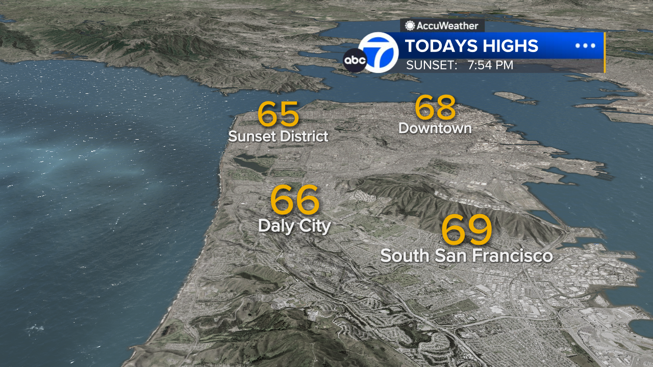
San Francisco High Temps
South Bay High Temps
- Download: ABC7 Accuweather app for iPhone and Android
- CA Weather Tracker: Reservoir levels, precipitation trends, snowpack totals
- Weather Radar: LiveDoppler7 radar images
- Weather Alerts: Current Watches and Warnings
- Share: Tag weather photos #ABC7Now
SHARE YOUR PHOTOS: We love seeing photos and videos from where you live! Share yours by posting with #abc7now. You must have taken the image/video or otherwise own all rights to it and agree that KGO-TV and its licensees can use, edit and distribute it without restriction in all media. Full terms: abc7news.com/share