AccuWeather Forecast: Minor cooling starts tomorrow

Takeaway of the Day
This weekend winds down on a bright, mild, and breezy note. It was sunny for most of the day, with high temperatures ranging from mid-60s at the coast to lower 70s near the bay to mid-70s inland. We may notice a slight increase in high clouds tonight, with overnight lows mainly in the lower 50s, but there will be a few mid-to-upper 40s in farther inland locations.
A Look Ahead
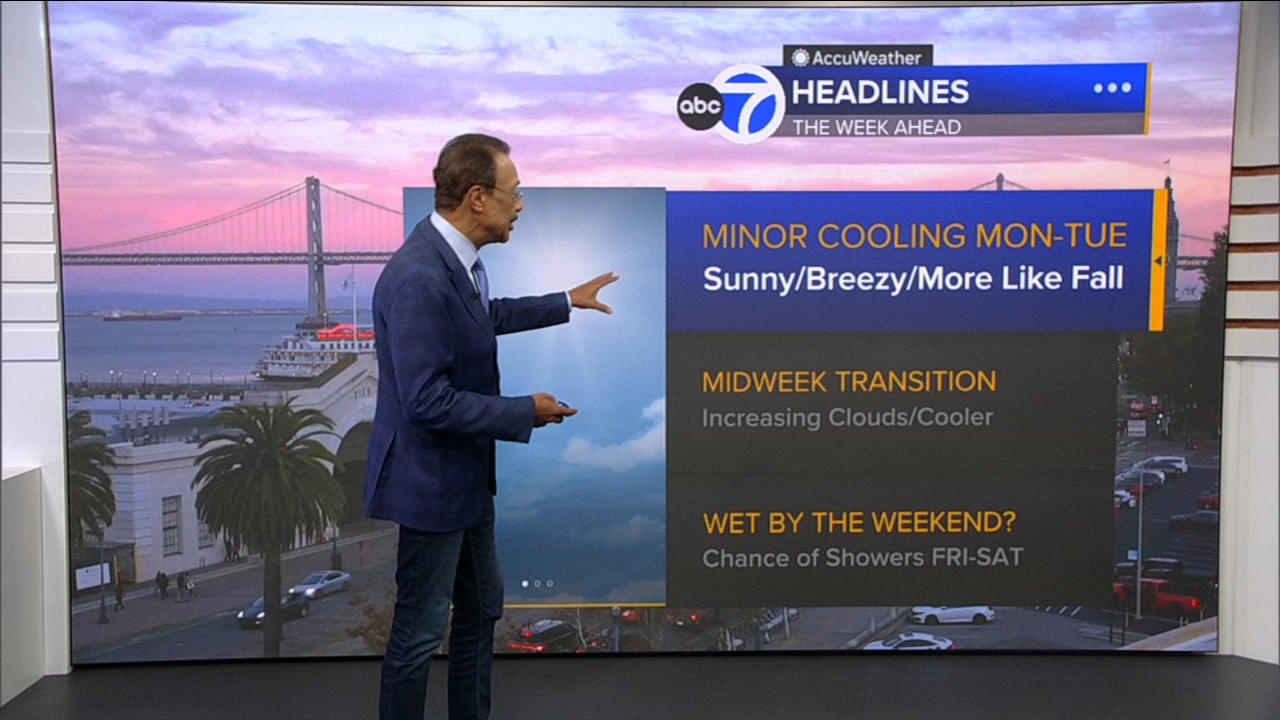
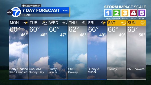
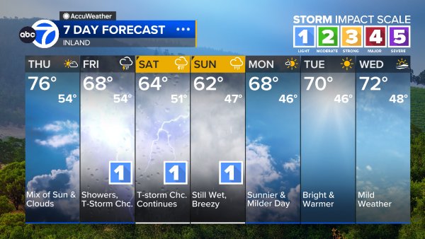
Tomorrow and Tuesday will bring slightly cooler weather, under mostly sunny skies--but clouds will increase Wednesday and Thursday, and showers are likely from late Friday through the weekend. A COASTAL FLOOD ADVISORY remains in effect until 3 p.m. Thursday. During high tides, there is a chance of localized flooding along the Pacific coast and along the shorelines of San Francisco Bay and San Pablo Bay--mainly in low-lying areas.
Coast
Bay Shoreline
Inland
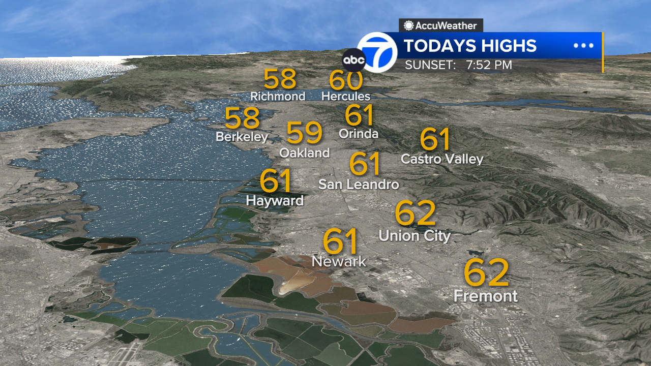
East Bay High Temps
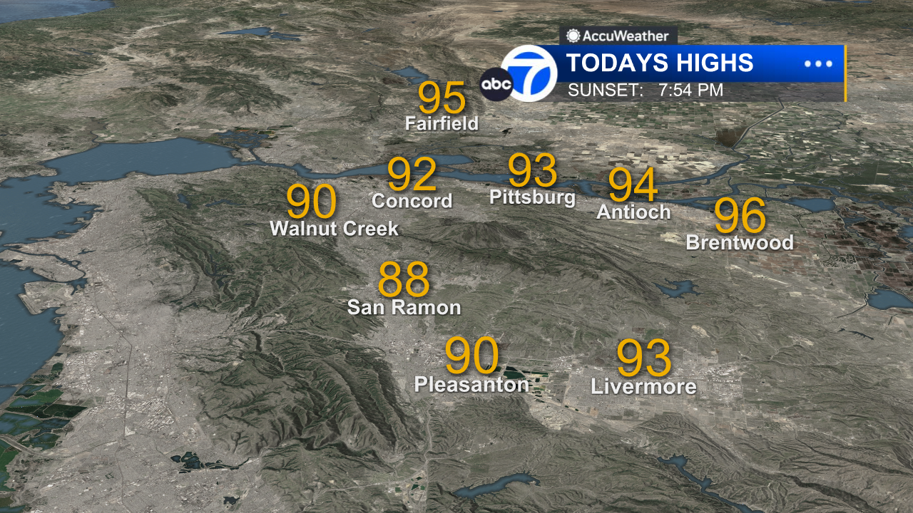
Inland East Bay High Temps
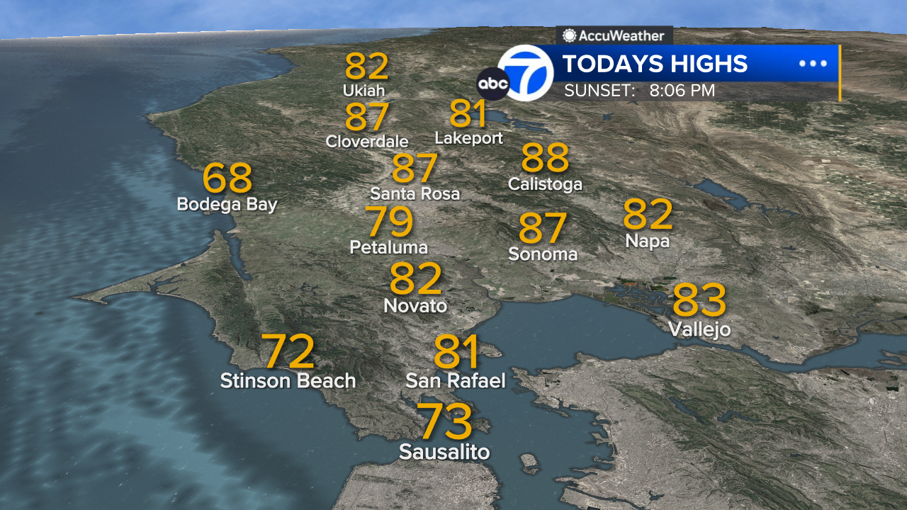
North Bay High Temps



Peninsula High Temps
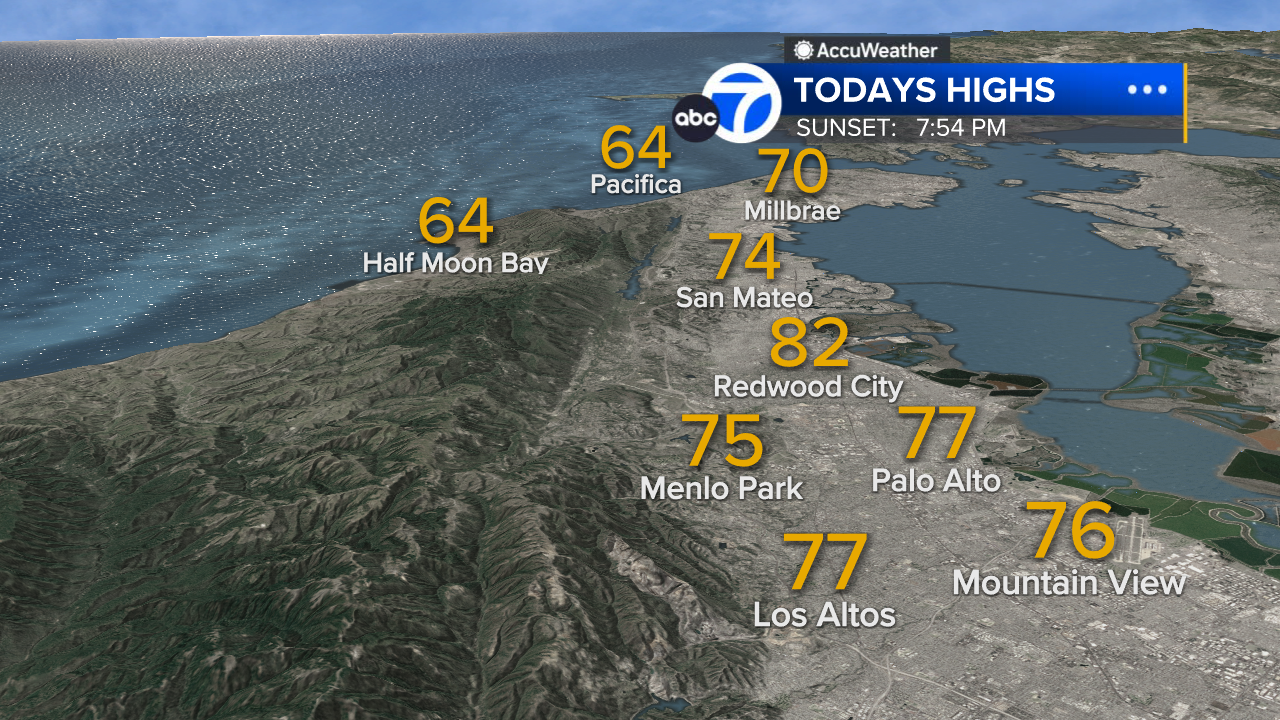
San Francisco High Temps
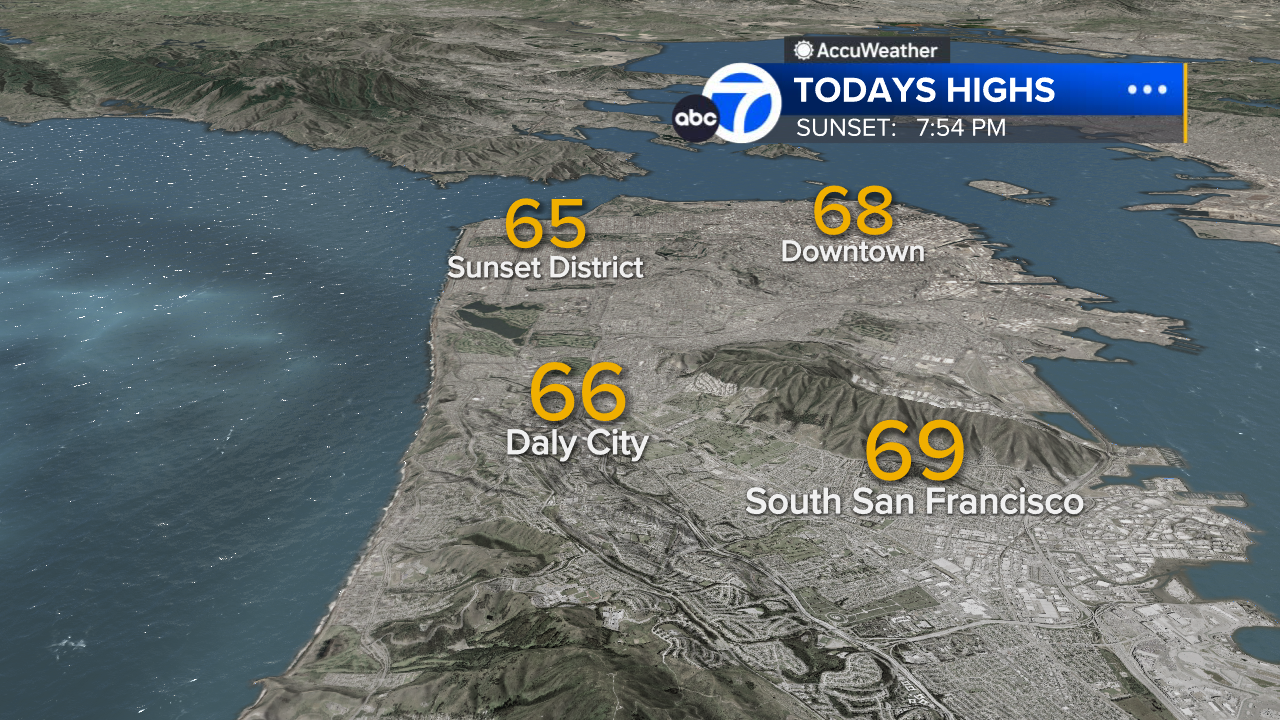
South Bay High Temps
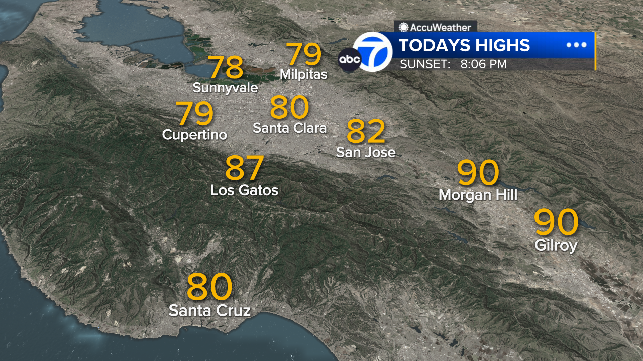
- Download: ABC7 Accuweather app for iPhone and Android
- CA Weather Tracker: Reservoir levels, precipitation trends, snowpack totals
- Weather Radar: LiveDoppler7 radar images
- Weather Alerts: Current Watches and Warnings
- Share: Tag weather photos #ABC7Now
SHARE YOUR PHOTOS: We love seeing photos and videos from where you live! Share yours by posting with #abc7now. You must have taken the image/video or otherwise own all rights to it and agree that KGO-TV and its licensees can use, edit and distribute it without restriction in all media. Full terms: abc7news.com/share