Russian River communities learn from past El Niño disasters as they prepare for this winter

RIO NIDO, Calif. (KGO) -- Residents and officials in parts of Sonoma County are preparing for another potentially wet winter, drawing on lessons learned from past disasters as forecasts call for a strong El Niño season.
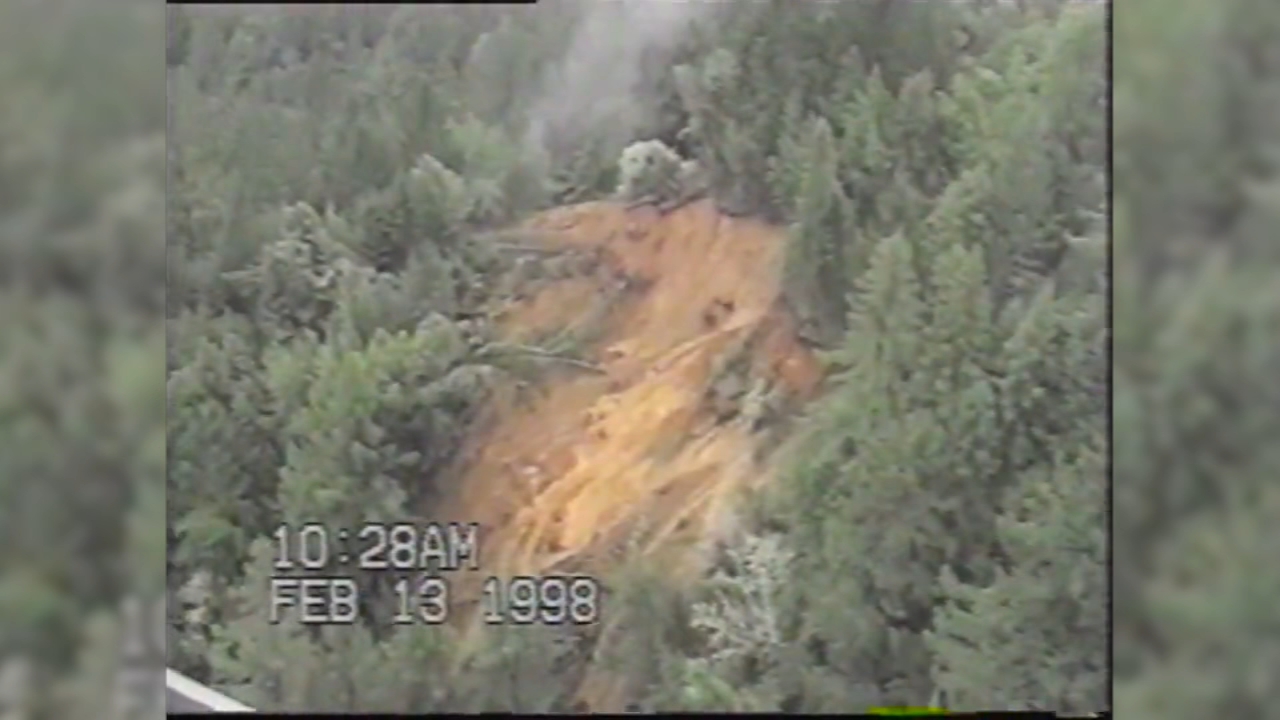
In Rio Nido, reminders of one of the area's worst weather-related disasters remain visible decades later.
Warning signs and barriers still mark a hillside that collapsed during intense storms in February 1998 after heavy rainfall saturated the ground.
"There are still houses that are underground up there, complete homes, probably still full of furniture and everything," said Rio Nido resident Terry Aldrich.
The 1998 mudslide buried dozens of homes and vehicles, forcing about 140 families to evacuate.
The disaster attracted national attention, including a visit from then-Vice President Al Gore.
El Niño Effect: How climate pattern could reshape California's winter
With memories of that event still fresh for longtime residents, community members and county officials have spent years strengthening infrastructure designed to reduce the risk of similar damage.
"Under the road, there is now, there's a five foot culvert pipe," Aldrich said.
He explained that officials believe the hillside became saturated because water had no effective drainage route.
"Cause, apparently what happened before the slide it just got saturated and then it started to pack up and the water had nowhere to go except just keep getting more and more then it just turned into gravy," Aldrich said.
Today, the drainage system includes a large culvert, protective grates designed to prevent fallen trees from creating blockages and a nearby pumping station intended to move water away from vulnerable areas.
Johannes Hoevertsz, director of Sonoma Public Infrastructure, said crews have worked extensively to prepare drainage systems for winter storms.
"We, this year, went and cleared all the drainage, some of the most difficult drainage we cleared this year so we're ready to get the water moving," Hoevertsz said.
MORE: El Niño winter: Bay Area airports face flooding risk during holidays, research suggests
Preparations also extend to nearby Guerneville, where flooding along the Russian River has historically posed a major threat. On a recent visit, low water levels contrasted sharply with memories of major floods.
"This is unbelievable, there's no water here. How far up does the water get?
Top Stories

Just on a regular storm. we see it to the parking lot, all the way up here, that's not even flood zone," said Guerneville resident Jason Crawford.
The Russian River's official flood stage is 32 feet.
In 1986, another El Niño year, the river reached a record 49.5 feet.
"The deepest I've ever seen it, you were able to touch the water from the bridge so it was up to it," Crawford said.
In response to repeated flooding, local officials have undertaken a variety of mitigation projects over the years. A new bridge replaced Guerneville's older truss bridge in 1998, and FEMA-funded programs helped some homeowners elevate their houses above flood levels.
Even so, residents remain cautious.
"A little bit frightened and concerned because the river comes very high over here at the right hand side," said Guerneville resident Alison Hatcher.
"My home is raised so I feel somewhat confident but I'm still worried," she added.
MORE: El Niño: SF declares local emergency to prepare for potential severe storms, coastal flooding
Emergency officials now activate local command posts 12 hours before the Russian River reaches flood stage.
This year, Sonoma County is also relying on new technology to improve emergency response and public communication.
"This year we have a better road closure system, we're using artificial intelligence, we're doing remote closures and openings. We have a system that we can inform Waze, Google Maps, Apple Maps, TomTom, we have better communication with the communities with social media," Hoevertsz said.
MORE: San Mateo Co. launches new radar system ahead of El Niño-fueled winter storms: Here's how it works
County officials say years of planning have left them better prepared than during previous El Niño events.
"We're actually looking forward to see what's going to happen so we can test all the stuff that we've been doing for years and see how it performs," Hoevertsz said.
For residents who have experienced major floods and landslides before, confidence is mixed with caution.
"And just from looking at years past and how long it's been since we've had a good flood, we're about due for it. So, a little nerve racking, but we'll make it," Crawford said.